The Urbanisation of Hornsey

An extract from John Farrer The Man who Changed Hornsey by Janet Owen London was sucking in people from the countryside as its industrial strength grew throughout the nineteenth century …
This section contains a wide range of articles about the history of the area.

An extract from John Farrer The Man who Changed Hornsey by Janet Owen London was sucking in people from the countryside as its industrial strength grew throughout the nineteenth century …

The land ownership and holdings of early manors (see The Manor and Sub-Manors of Hornsey) probably defined the borders of Hornsey Parish which contained the bishop of London’s Manor and …

The Manor of Hornsey was said in 1294 to have been part of the Bishop of London’s manor of Stepney from time immemorial. The bishop also claimed that his predecessors …

Present day Wood Green forms part of the London Borough of Haringey and is situated about six miles north of the City of London. A bustling place Wood Green is …

The mainly residential districts of neighbouring Bounds Green and Bowes Park form the north-east corner of the London Borough of Haringey with a small part in the south-east corner of …

The story of Alexandra Palace and Park is integral to that of Wood Green. This Victorian enterprise has been the subject of many trials and tribulations, but it has, nevertheless, …

Erected in 1848 as Hornsey Infants’ School for St. Mary’s Parish, the Old Schoolhouse, designed by architect John Henry Taylor, is now the home of the Hornsey Historical Society. Although …

Hornsey’s history as a parish and administrative area goes back to at least the 13th century. For most of that time, Hornsey was a rural backwater in the county of …

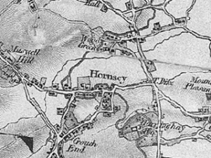
The Ordnance Survey was established in 1791 and the survey commenced in 1794 the first sheets to a scale of one inch to a mile were published in 1801. We …

The tower was built as part of the medieval church of St Mary when Hornsey was a small rural village in Middlesex. The lower part of the tower is medieval, …